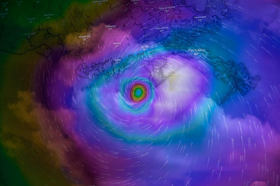
Scientists Warn of ‘Category 6′ Hurricanes: Louisiana Identified as Prime Target for Future Super Storms
In a recent study that is shaking up the way we think about hurricanes, researchers are pointing out that these storms are getting so intense, we might just need a whole new category to keep track. I wish I was kidding, but we're talking about bringing in a Category 6 for storms with winds over 192 mph. And before you think this is just some sensationalized piece to get you to click and scroll, the idea of a storm this crazy isn't just theoretical. According to NOLA.com, five of these monsters have already shown up since 2013, all of them reaching their final form in the Pacific.
Now, for folks in the Gulf of Mexico, and let's not forget our friends in the Philippines and Southeast Asia, this news hits close to home. These areas are tagged as prime spots where these supercharged storms could make landfall. According to Michael Wehner from Lawrence Berkeley National Laboratory and James Kossin from First Street Foundation, who published their findings in the Proceedings of the National Academy of Sciences, this uptick in storm intensity is all thanks to our warming climate. They're saying the risk of seeing a Category 6 hurricane in the Gulf could double if global temps rise 2 degrees Celsius above what they were before we started industrializing everything. And triple at a 4-degree increase. As of last summer, we're already at a 1.5-degree increase, so, yeah, not great.
The Saffir-Simpson scale, which has been our go-to for classifying hurricanes since the 1970s, might not cut it anymore. It's all about wind speed, but anyone who's been through a hurricane knows it's about a lot more than how fast the wind's blowing. Think storm surge, flooding, and even tornadoes. The problem is once a storm hits Category 5, that's as bad as the scale says it can get, even if it's way worse.
There's been a lot of chatter among scientists about tweaking the scale to better reflect the real risk from these storms, especially considering things like storm surge and flooding. But so far, those in charge at the National Oceanic and Atmospheric Administration (NOAA) haven't made moves to change the scale. That said, the way we forecast hurricanes is getting a second look, particularly the "cone of uncertainty" – because the impact of these storms often stretches far beyond that cone.
So, yeah, this study's kind of a big deal, especially for places like Louisiana that are right in the hurricane hotspot. It's a heads-up that we're in for more intense storms, and it's probably about time we start thinking about what that really means.
Check the full NOLA.com story here, and enjoy as much time as you can before we even have to start thinking about hurricane season.
LOOK: The most expensive weather and climate disasters in recent decades
Gallery Credit: KATELYN LEBOFF
More From News Talk 96.5 KPEL