Tropical Storm Erika Stronger This Morning
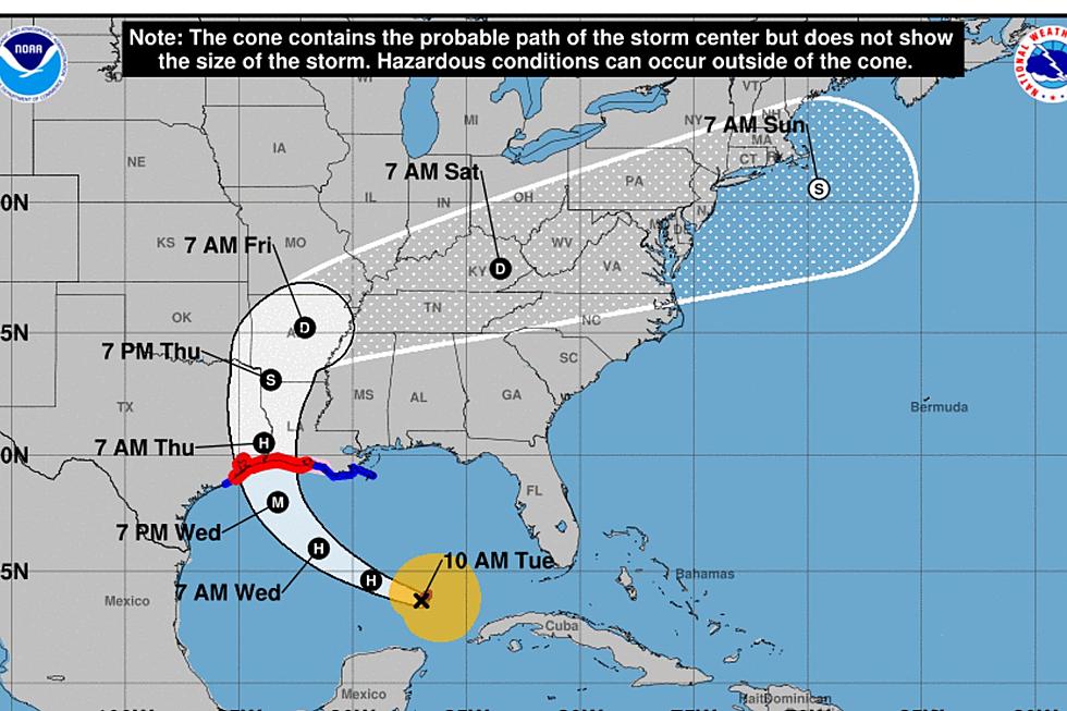
The center of circulation for Tropical Storm Erika is currently passing between the islands of Antigua and Guadeloupe this morning. The storm has shown an increase in intensity in the overnight hours and forecasters expect Erika to reach hurricane strength over the weekend. By early Monday morning interest along Florida's Atlantic Coast could be feeling the effects of Erika.
The official forecast track from the National Hurricane Center will pull the center of Erika along the coastline but just just offshore. If this track is correct the storm might be a greater threat further to the north in coastal Georgia and the Carolinas. Only time will tell exactly what will happen.
The forecast model runs of 2am Eastern this morning are projecting a possible landfall any where from near Charleston South Carolina to as far north as Cape Hatteras North Carolina. Some of the models pull Erika out to sea before crossing the coast line of the United States at all.
More From News Talk 96.5 KPEL