Acadiana’s Real Tropical Threat Could Come Next Week
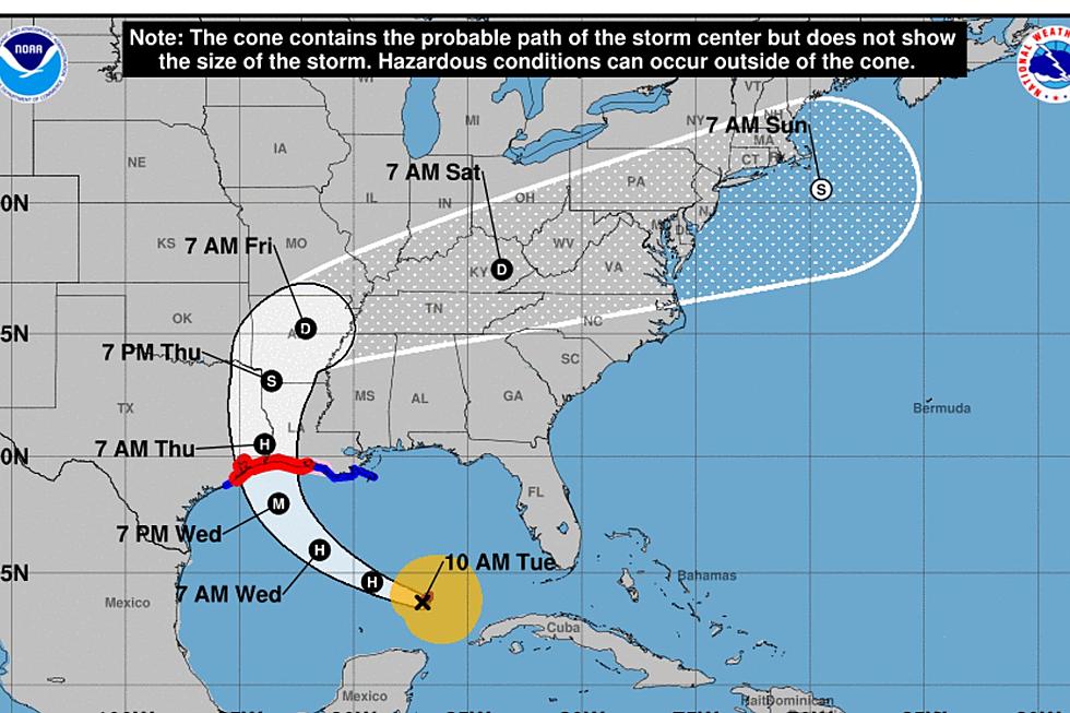
As of 2 am this morning the center of Tropical Depression 8 was centered about 360 miles south southeast of Lafayette. The storm is forecast to become Tropical Storm Hanna either later tonight or sometime tomorrow. The track forecast for this system brings it onshore over the weekend on the middle or lower Texas coast.
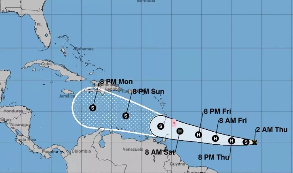
While this system is currently in our own backyard, there could be an even more ominous tropical issue looming with Tropical Storm Gonzalo. That system is still well out in the Atlantic Ocean east of the Lesser Antilles Islands. It is forecast to move across those island nations and into the Caribbean Sea over the weekend.
Gonzalo is forecast to become Hurricane Season 2020's first hurricane later today but it might lose some of its steam before it moves into the Caribbean. From there the tropical forecast models are in a general agreement that the system will likely move into the Gulf of Mexico by about this time next week.
Obviously a tropical forecast extrapolated over a period of time more than a few days is not going to be that accurate. But, when you have a vast majority of the model guidance lining up in a similar fashion you should take note.
That's what we are doing.
The National Hurricane Center's official track and intensity forecast do call for Gonzalo to weaken as it gets into the Caribbean Sea. In fact, the storm system's relatively small size makes it very vulnerable to atmospheric conditions such as wind shear, Saharan dust, and dry, stable air.
So, it is entirely possible that Gonzalo could fall apart over the Caribbean or be influenced by a landmass such as Cuba before it even has the opportunity to move into the Gulf of Mexico.
We just wanted you to know that after Tropical Depression 8 or Tropical Storm Hanna as it is likely to become moves off your newsfeed this weekend, there could be another reason to keep your eyes on the Gulf. As always we'll have the latest information on any threat to your family's safety and security.
More From News Talk 96.5 KPEL