Major Hurricane Matthew Will Threaten U.S. Coast
What's the old saying? Close only counts in horse shoes and hand grenades? I guess we can now add hurricanes to that list. Residents along the East Coast of Florida and all along the Eastern Seaboard of the United States are preparing for a brush from Hurricane Matthew over the next few days.
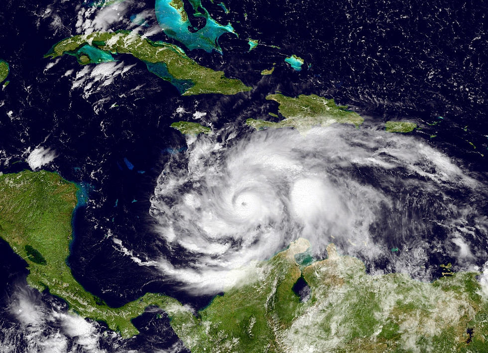
At the 4 AM advisory from the National Hurricane Center the storm had lost its Category 4 status and was down graded to a Category 3 storm. The system was beginning to move north of the southeastern tip of Cuba.
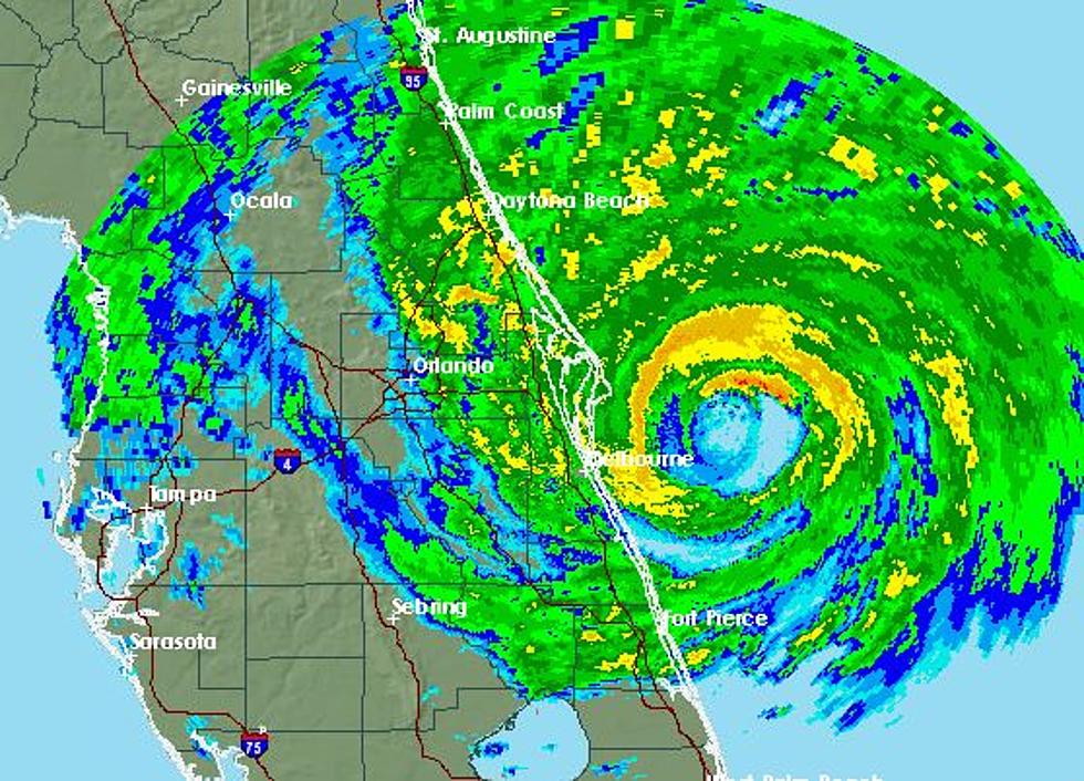
The forecast track for Matthew is expected to carry the storm the length of the Bahama Island chain and bring the center of circulation dangerously close to east coast of Florida. Hurricane warnings and watches have been posted for much of Florida's Space Coast.
Currently forecast models are in agreement that the center of circulation will stay just off shore. In this case just how far off shore will make a huge difference. The wind field for Matthew is relatively small. Hurricane force winds, winds of 74 mph or greater, extend outward from the center for only 45 miles.
The larger area of those hurricane force winds are to the east of the center of circulation so that does bode well for the coastline. However, tropical storm force winds extend outward from the center of the storm approximately 175 miles.
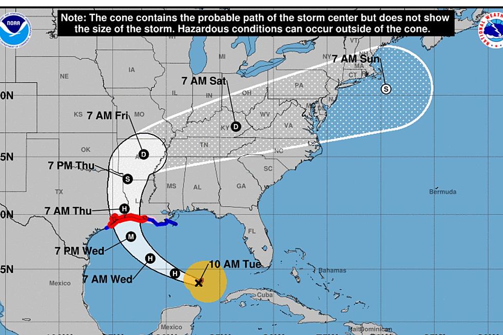
The track forecast from the Hurricane Center suggests that the storm will parallel the coastline. The storm is expected to turn northeast paralleling the Georgia and South Carolina coast later in the forecast period. Since that is motion would still be several days away the confidence on exactly when that turn will occur is not very high.
More From News Talk 96.5 KPEL
![Louisiana Doctor And Organization Helping Haiti After Hurricane Matthew [PHOTOS]](http://townsquare.media/site/33/files/2016/10/nicole.jpg?w=980&q=75)