Much Of Louisiana Facing Severe Weather Threat For Thursday
Forecasters with the Storm Prediction Center have placed a large portion of the state on notice for the possibility of strong storms, tornadoes, and damaging winds during the day on Thursday.
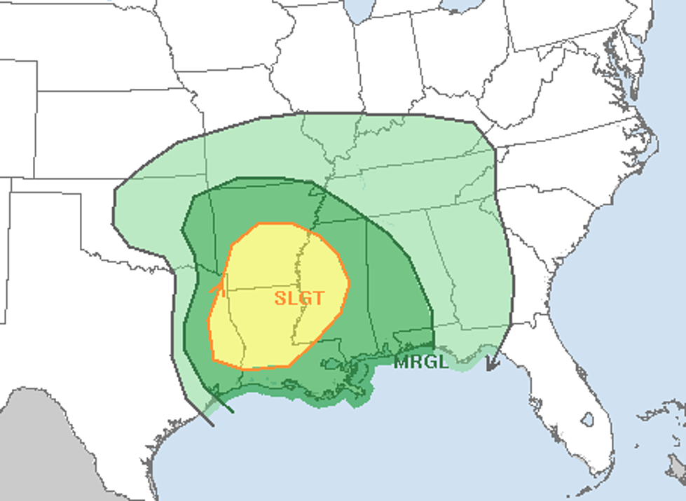
The advisory from the severe weather forecast wing of the National Weather Service suggests that the greatest threat from strong storms will likely occur along and north of I-10 from Lake Charles to Baton Rouge. This area of the state has been placed under a slight risk of severe weather for Thursday.
The areas south of I-10 are in the marginal risk category according to the SPC. Regardless of whether storms associated with an approaching weather system reach severe limits on Thursday, it's a pretty good bet that most of us will see some rain.
Forecasters with KATC TV say 80% precipitation coverage is what we can expect during the day on Thursday. As of now, forecast models suggest that scattered showers ahead of an approaching storm system could begin in the early morning hours of Thursday and linger into Thursday evening.
More From News Talk 96.5 KPEL