
Tropical System Likely to Strengthen Later Today
Forecasters with the National Hurricane Center are suggesting that the 2020 Hurricane Season could be less than 24 hours away from having its next tropical depression or even named storm. Forecasters have bumped the probability of a tropical wave becoming a tropical cyclone in the Atlantic Ocean from 50% yesterday to 70% today.
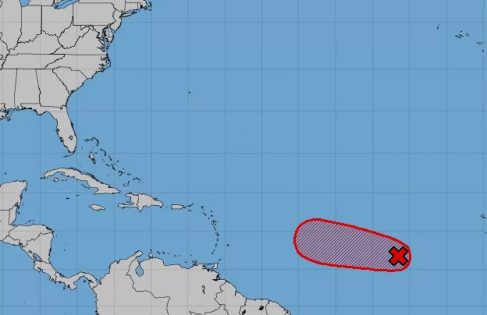
The system, designated by the Hurricane Center as Invest 95L remains far from any large landmass. As of early this morning, the area was situated some 800 miles west of the Cabo Verde Islands. The Hurricane Center describes the system as an area of thunderstorms associated with a large low-pressure system.
Over the next couple of days, atmospheric conditions should be conducive for the system to strengthen and develop. Should it reach tropical storm status it would be given the name Josephine. However, forecasters are quick to remind us that the system will encounter some hostile conditions by the end of the week that could snuff it out before any further development happens.
Tropical forecast model guidance is suggesting that the system, in whatever form it happens to be over the next few days, will likely approach the islands of the Caribbean and then take a decided turn to the north into the open Atlantic. This would be a best-case scenario for everyone concerned. However, tropical forecasts can change and often do, so we'll continue to monitor the system until it's no longer an issue.
Elsewhere across the tropical Atlantic Basin conditions appear to have calmed down considerably. There are no other tropical hot spots being watched for organization other than the one we have detailed earlier in this article.
By the way, we aren't even close to the peak of Hurricane Season. That will come on the 10th of September and forecasters believe we will have many more storms to deal with by the time the season comes to a close on the last day of November.
12 Ways to Help Your Air Conditioner Cool Your Home Better
More From News Talk 96.5 KPEL

