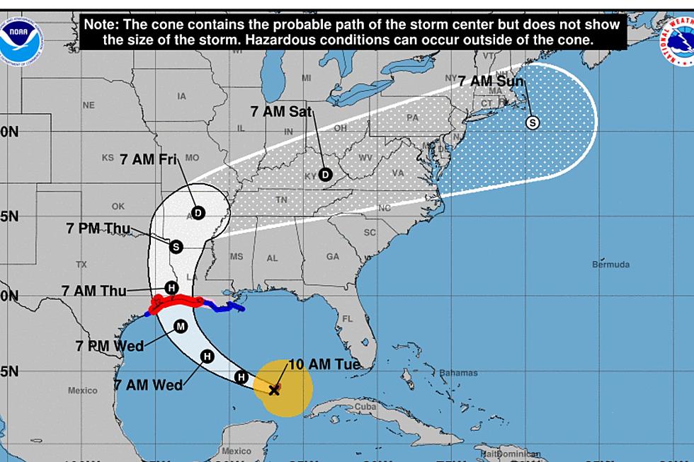
Tropical System Still Poised For Development In Gulf Of Mexico
Forecasters with the National Hurricane Center say a storm system in the southwest Gulf of Mexico could still strengthen into a tropical cyclone. The Hurricane Center has given the system a 60% probability to develop into either a tropical depression or tropical storm over the next five days.
The broad area of low pressure surrounded by showers and thunderstorms is in the Bay of Campeche and that puts it well away from any interaction with the U.S. coastline at this time. However, residents of northeastern Mexico should be preparing for a very heavy rain event this week.
Most of the reliable tropical models suggest this system will slide north to northwest paralleling the eastern Gulf coast of Mexico. Some of the long range models show the system being picked up and dragged across Louisiana not as a tropical system but as a prodigious rainmaker. Some models follow the system as both.
Chief Meteorologist Rob Perillo posted concerns on the KATC website that Louisiana's biggest threat from this system might not be wind but water. As in falling water with some tropical forecast models predicting copious amounts of rainfall in the area by Thursday.
Regardless, any threat or threats from this system are still days away and there is more than ample time to make preparations should they be deemed necessary.
More From News Talk 96.5 KPEL