Tropics – System In Gulf Could Strengthen, Florence Weaker
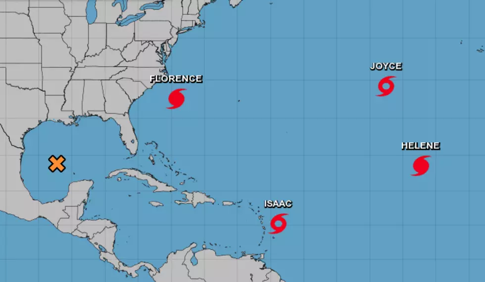
The National Hurricane Center is currently tracking two hurricanes, two tropical storms, and a developing tropical depression. Yes, this is the peak of the Atlantic Hurricane Season.
Sub-tropical storm Joyce formed yesterday in the north-central Atlantic Ocean. Joyce, along with Hurricane Helene are not expected to pose any threat to any major landmass, at least anytime in the near term.
Tropical Storm Isaac continues to push westward in the lower latitudes. The system should pass through the Windward Islands and into the Caribbean Sea later today. The current forecast track for Isaac does bring the storm near Mexico's Yucatan Peninsula by next Monday. From that point, there is a great deal of uncertainty with Isaac.
Hurricane Florence is the current meteorological focal point. The system has weakened from Category 4 status to Category 2 on the Saffir-Simpson scale. While that's good news it doesn't mean that Florence won't create havoc, danger, and destruction when she makes landfall somewhere near the North Carolina/South Carolina border either very late tonight or early Friday morning.
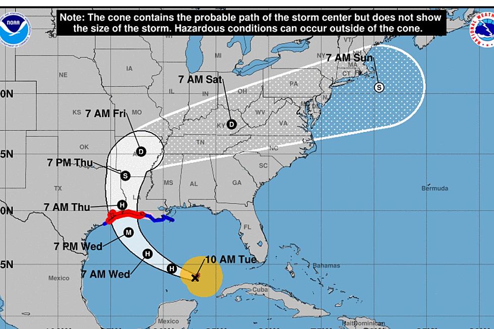
As far as the Gulf of Mexico is concerned Hurricane Hunter aircraft are expected to fly into the system which is currently located several hundred miles southeast of Brownsville Texas.
This system has been given a 60% probability of strengthening into a tropical depression as it moves toward the lower Texas coast. Most forecasters agree that the greatest threat from this potential depression will be an increase in rain chances as the system moves inland over the next few days.
More From News Talk 96.5 KPEL


![Watch Hurricane Florence As It Makes Landfall [Live Cam]](http://townsquare.media/site/33/files/2018/09/Hurricane-Florence-Live-Cam.png?w=980&q=75)

![Unintentionally NSFW Weather Forecast Sparks Hilarious Comments On Social Media [PHOTO]](http://townsquare.media/site/34/files/2018/09/Screen-Shot-2018-09-12-at-6.23.14-AM.png?w=980&q=75)


