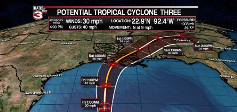
Who Will Potential Tropical Cyclone 3 Impact Along Louisiana Coast?
Governor John Bel Edwards has issued a state of emergency as a potential tropical cyclone is headed toward the northern Gulf Coast.
Weather forecasters have issued a tropical storm warning from Intracoastal City, Louisiana, to the Alabama-Florida border as residents along the coast continue to monitor what is expected to be a Tropical Depression make landfall. Heavy rainfall and flooding is what forecasters are warning the storm will bring when it reaches the coast beginning on Friday.
The storm has maximum sustained winds of 30 mph.
“According to the National Weather Service (NWS), rainfall will be the biggest threat,” said Gov. Edwards in a press release. “In addition to heavy rains, there is also a threat of coastal flooding, tropical storm force winds and isolated tornadoes. The Governor’s Office of Homeland Security and Emergency Preparedness (GOHSEP) has activated its Crisis Action Team and stands ready to support our local partners with any emergency resources needed beyond parish capabilities. It is important to stay weather aware as these storms approach the coast."
In Acadiana, Vermilion Parish says they are on the ready as the storm is currently expected to make landfall near Morgan City, east of the parish. How will the storm impact Vermilion Parish? It all depends on where the rain bands form. Sheriff's Office PIO Eddie Langlinais says, in the bands, rain totals could be three inches.
As of now, most of the rain is expected east of New Orleans into Mississippi.
"Like all gulf storms, we are watching this storm closely," says Langlinais in a press release. "TEAM VPSO has begun testing rescue equipment and has made preliminary plans to activate rescue teams if needed. (The Vermilion Parish) Sheriff's Office is ready. Please watch this storm closely and develop your storm plans accordingly."
KATC Chief Meteorologist Rob Perillo says much of the flooding and potential severe weather is expected to stay east of Acadiana.
Hurricane Game Plan, How We Get Ready at My House
Guess Louisiana Cities from Satellite Photos
More From News Talk 96.5 KPEL


