Hurricane Center Watching Another Area of Concern in Caribbean
Stop me if you heard this before. An area of disturbed weather is being monitored by the National Hurricane Center in the Caribbean just off the coast of Honduras. If you follow tropical weather that could affect the Gulf of Mexico then you have heard this before. This was the same area of the ocean that gave birth to Hurricane Ida last month and the recently formed Tropical Storm Mindy which made landfall in Florida yesterday.
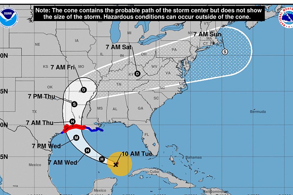
In an eerie similar forecast track projection, forecasters are suggesting that this system will push across southern Mexico and enter the Bay of Campeche. This is what the original forecast tracks for Ida and the original forecast tracks for Mindy suggested as well. However, both of those storms took a different path and did not head for northern Mexico as the original track forecast suggested.
As of early this morning, forecasters with the National Hurricane Center are giving this area of disturbed weather a 20% probability of becoming a tropical cyclone over the next five days. The Hurricane Center's Five Day Tropical Outlook states,
The northern portion of a tropical wave over the western Caribbean Sea is forecast to emerge over the southern Bay of Campeche on Saturday. Environmental conditions are expected to be conducive to support some gradual development of the system before it moves
into mainland Mexico early next week.
Again, the original forecast tracks of Ida and Mindy basically said the same thing. As we look at the tropical weather forecast models, the GFS Model does not show tropical development in the Gulf of Mexico. However, it does pick up on the moisture from this system sliding up the western Gulf Coast through Texas early next week.
The European Model doesn't show any signs of tropical development in the Gulf of Mexico either. But still, we are literally at the peak of the Atlantic Hurricane Season and sea surface temperatures in the Caribbean and Gulf of Mexico are very warm so any system with a potential spin does need to be monitored.
By the way, it is important that you know these model forecasts are just that, they are models and not official forecasts so don't ever make a life or death decision based on a forecast model.
Meanwhile, residents of Louisiana can expect a bit of relief from at least the humidity we've been experiencing as soon as this afternoon. A cold front is currently pushing southward across South Louisiana. That front is expected to stall along the coast but will at least offer the I-10 corridor a bit of a break from the excessive heat indices we've experienced the past several weeks.
Enjoy it while you can as the long-range forecast for South Louisiana shows a return of showers and thunderstorms by Sunday with higher rain chances in the forecast for early next week. Oh, and at least one weather guesser is suggesting "it might feel like fall" in just a few weeks. So, we might as well get ready for that too.
Best Places to See Beautiful Fall Foliage in Louisiana
More From News Talk 96.5 KPEL
