Tropical Threat Still Minimal for Louisiana’s Coastline
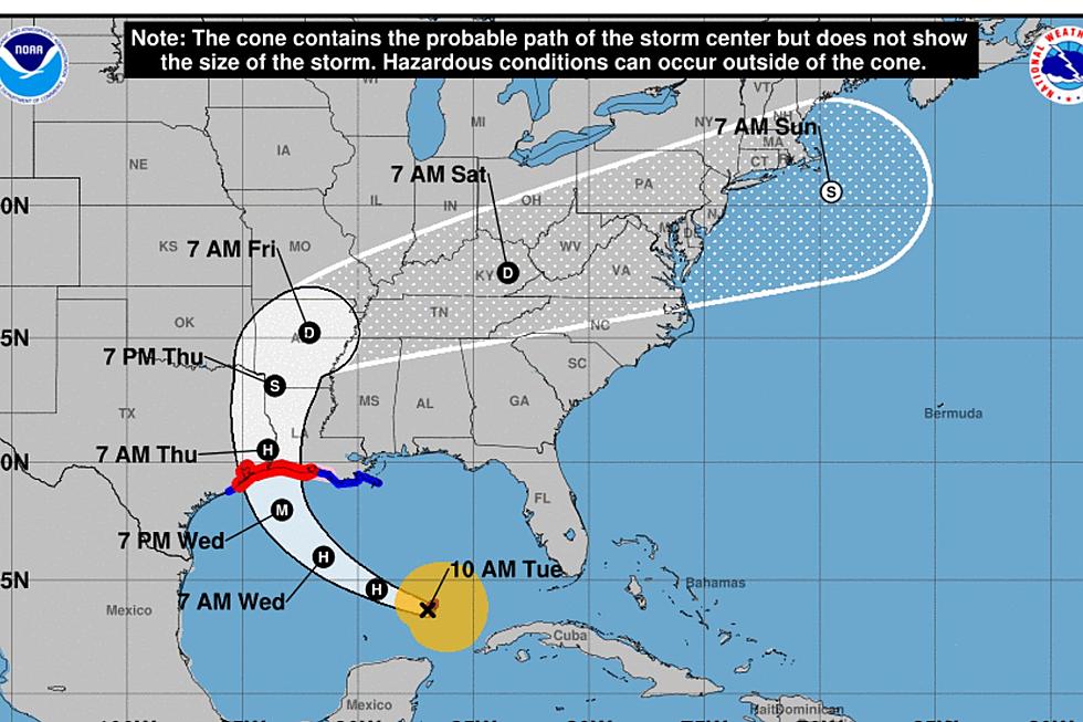
An area of low pressure in the northern Gulf of Mexico continues to pose a minimal tropical risk to Louisiana's coastline this morning. The system, which is a remnant from a decaying frontal boundary is currently being monitored for further development by the National Hurricane Center.
The concern among tropical forecasters is this. The longer the system stays over the very warm waters of the northern Gulf there will be potential for strengthening. Louisiana has seen its share of tropical systems spin up right along the coast over the past few decades and there is no reason to believe something similar couldn't happen with this weather system.
Forecasters with the National Hurricane Center are not bullish on the storm system getting its act together anytime soon. In fact, the Hurricane Center has given it only a 30% probability of growing into a tropical depression over the next five days.
Just because we may not have a big storm or a storm with a name doesn't mean we won't be feeling the effects of this system throughout the week. The biggest threat/benefit from the storm system will be rainfall. If the system provides gentle soaking rain it will ease drought conditions in the state.
If the system produces tropical downpours, which is more likely, then we will have a risk of flash flooding and localized street flooding under the heavier showers. KATC TV 3 Chief Meteorologist Rob Perillo is thinking that the majority of the very heavy rainfall will be east of Acadiana and Southwest Louisiana but we'll still get our share of showers.
In his weather blog on the KATC website, Perillo suggests that there is the potential for the Lafayette area and maybe even as far west as Lake Charles to be on the receiving end of three to five inches of rainfall by the end of the week. However, the Euro Rainfall Model, pictured below is now suggesting that our rain accumulations won't be quite that large.
The newer runs of the GFS rainfall model are echoing the same thing. You can see Rob's graphic depicting the GFS below. The GFS model does suggest that the system in the Gulf will slide a little further west than the Euro model does, hence the greater rainfall totals.
What we do know is that the rain chance will be above normal for this time of year. This might not be a bad thing because if it doesn't rain it will just be hot and humid. The KATC Weather crew has the rain chance pegged at 50% for today. But an increased threat of showers and storms is in the forecast for Wednesday through the end of the week.
The bottom line is this. Keep checking back for the latest tropical development news and take your umbrella even if the skies are clear in the morning because you'll probably need that umbrella at some time during your workday.
10 Handy Home Remedies to Take the Itch Out of Mosquito Bites
More From News Talk 96.5 KPEL
