
Acadiana at Marginal Risk for Severe Storms Today
As of this weekend, it officially became Summer in Acadiana and the heat and humidity took the change in the calendar right in stride with a round of showers and thunderstorms brought about by the combination of those two atmospheric ingredients. Based on the forecast we can expect a lot more of that combination, heat, humidity, and thunderstorms for the next several days.
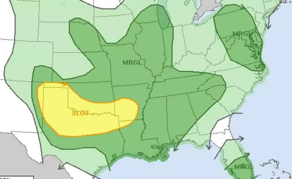
The Storm Prediction Center has placed much of Louisiana in the "marginal risk" zone for severe storms today. It does appear as if northwestern Louisiana will likely see the heavier showers or storms today and Tuesday but a severe storm can't be ruled out for just about anywhere in the state this afternoon and in fact, for most afternoons this week.
An upper-level low-pressure system will be approaching the area from the west. This will lead to atmospheric instability and the circulation around the upper low will draw an abundance of moisture in from the Gulf of Mexico over the state.
The current radar scan from the National Weather Service Office out of Lake Charles shows showers and thunderstorms are already moving northward out of the Gulf this morning.
Rainfall totals over the next 24 hours could be close to one inch in many locations. Some areas could receive higher amounts in locally heavy thunderstorms. Look for an increased threat of rain and storms to continue until at least Thursday. That's when forecasters believe some of that Saharan dust from Africa will make its way into Louisiana and help dry out our atmosphere just a little.
Your Very Own Private Paradise
More From News Talk 96.5 KPEL


