Despite Storms South Louisiana is Abnormally Dry
Spring in South Louisiana is usually a very damp and muggy time. As our part of the country transitions from the not so warm months of winter into the oh my gosh it's hot months of summer there are usually a lot of storms. While we have seen storms forecast for the area on several occasions this spring it sure does seem as if they've all moved north of Acadiana.
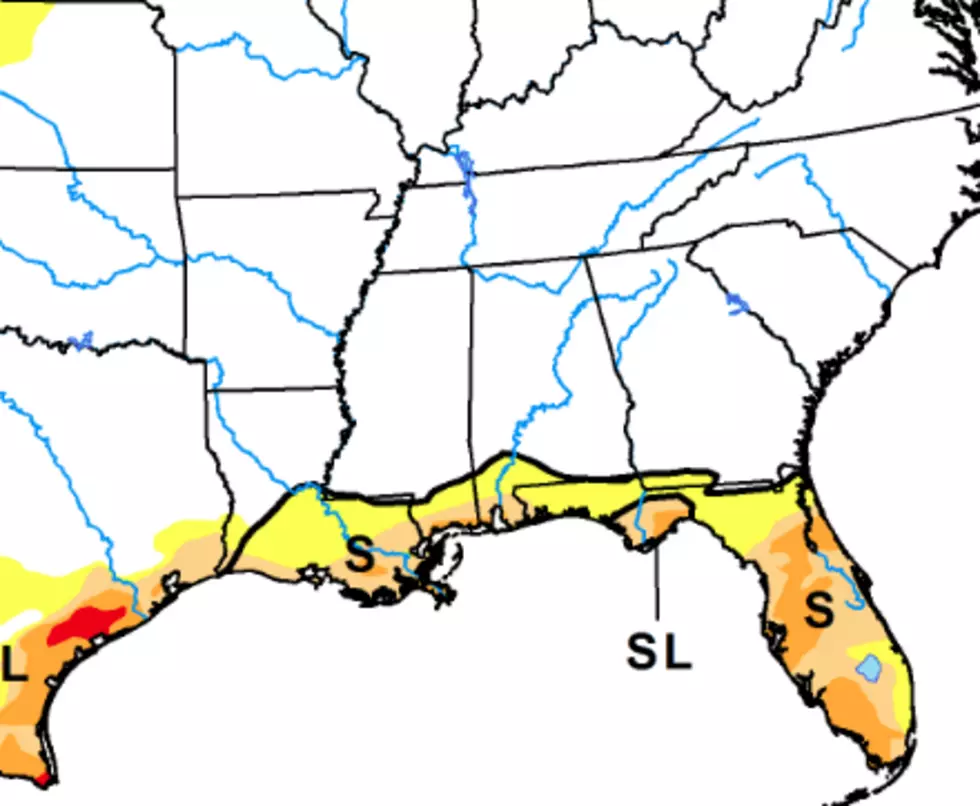
The most recent information released by the U.S. Drought Monitor seems to suggest just that. If you look at the image above you can almost picture where the storm track has been. For the most part, storms have been moving northeast out of Texas and tracking along or north of the U.S. 190 corridor.
This storm track has left a lot of coastal Louisiana high and dry. Okay, not high because we're basically at sea level but for goodness sakes, it just hasn't rained that much. As of now, the abnormally dry conditions are affecting pastureland and agricultural interests but this could be a foreshadowing of things to come.
Climatologists say July is the Lafayette areas wettest month based on averages and October is our driest month. Still, if we move into the heat of summer behind on our rainfall you could once again find watering restrictions implemented for yards and gardens across the area.
As of now, the next real threat of showers won't arrive in the area until Wednesday of next week. So, if you've been using your Stay-at-Home time to work in the yard, you might want to invest in a sprinkler or a good garden hose to make sure your hard work won't dry up and blow away.
READ MORE: Tropical Cyclone Categories and What Exactly They Mean
More From News Talk 96.5 KPEL