Tropical System Takes Aim at Florida Coast
The remnants of a Pacific Hurricane are in the process of strengthening to become a tropical cyclone in the Atlantic Basin. Forecasters with the National Hurricane Center say the area of disturbed weather they've been watching since last week has moved over the warm waters of the southern Gulf of Mexico this morning.
The system, which was still classified as "Potential Tropical Storm One", is expected to become a tropical storm later today. The Hurricane Center has the probability at 90% but just looking at satellite images you can see with your own eyes this storm is becoming better organized.
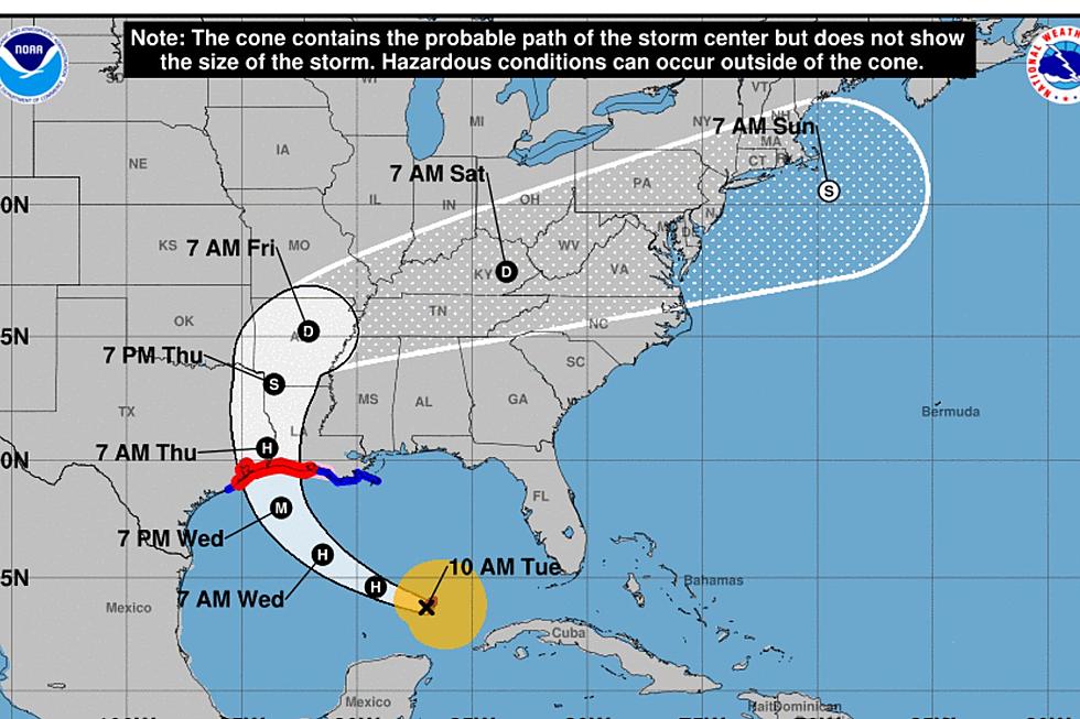
The storm was centered about 95 miles north of Cozumel Mexico as of 0100 am EDT. It was moving toward the northeast at five miles per hour. The maximum sustained winds were reported to be just below the tropical storm threshold at 35 mph.
The track forecast for the storm that is likely to earn the name Alex later today suggests a landfall on the western coast of Florida between Tampa Bay and Fort Myers. As of now, model guidance suggests that the system will be at best a minimal tropical storm if it reaches that classification.
The environmental conditions keeping the development of this system under wraps are the winds in the upper levels of the atmosphere. Those strong breezes have quelled any intensification and that's a very good thing for those in the path of this storm system.
The biggest threat from the storm will be heavy rain. Some areas of southern Florida including the Keys could see up to ten inches of rainfall or more before the storm moves across the peninsula and into the Atlantic.
But as far as Louisiana is concerned we should feel no effects from the system. Although it would be a good idea to take a minute and restock your hurricane kit if you haven't done that already. And when you get that done, how about some getaway time?
Eight Amazing Airbnbs in Louisiana
More From News Talk 96.5 KPEL
