![With 2 Potential Storms In The Gulf, Louisiana Could Possibly Experience The Rare ‘Fujiwhara Effect’](https://townsquare.media/site/34/files/2020/08/Screen-Shot-2020-08-21-at-6.47.59-AM.jpg?w=980&q=75)
With 2 Potential Storms In The Gulf, Louisiana Could Possibly Experience The Rare ‘Fujiwhara Effect’
Are you ready for the Fujiwhara effect?
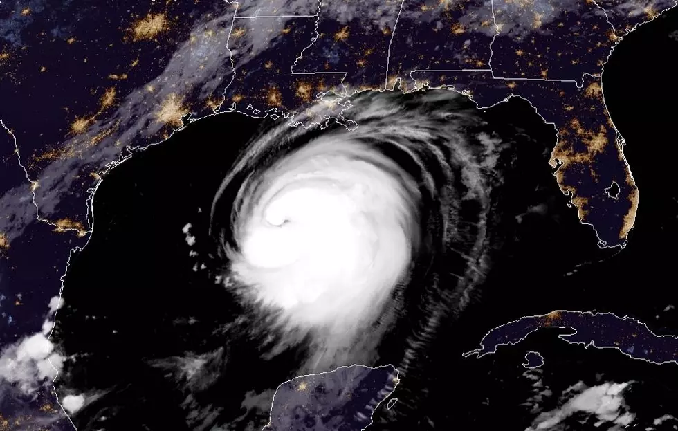
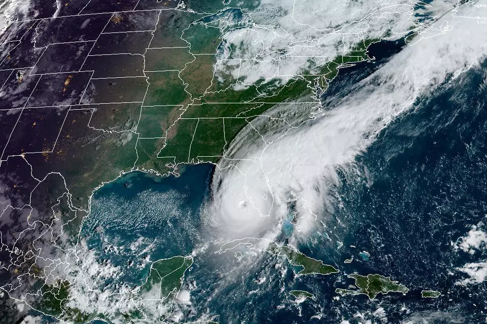
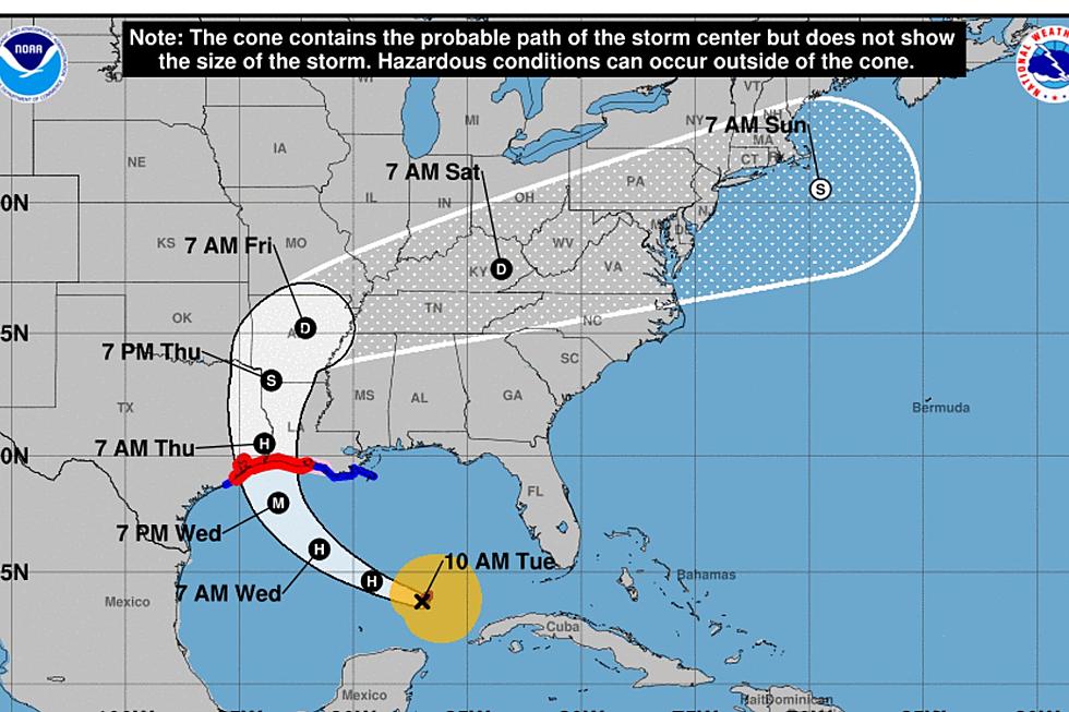
It sounds like some sort of ancient ritual and in some ways, that's exactly what it is. A Fujiwahara effect is when "two nearby cyclonic vortices orbit each other and close the distance." As of today, it is possible that we may have two tropical storms in the Gulf of Mexico early next week.
While social media throws around "Perfect Storm" movie quotes, KATC meteorologist Daniel Phillips broke down the likely reality of what we'll probably see between these two "storms" via Twitter.
This has only happened twice before: September 1933 and June 1959.
According to WBRZ, something similar took place back in 2002
Tropical Storm Fay made a track towards Texas, while Tropical Depression Edouard was coming off the western coast of Florida. Tropical Depression Edouard ended up being absorbed by more intense Tropical Storm Fay.
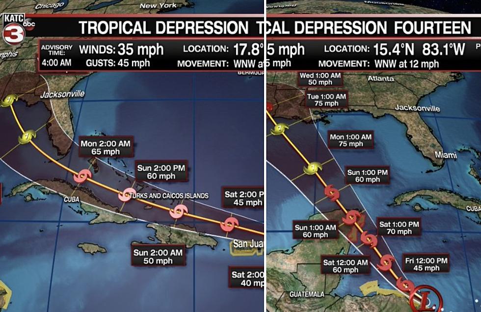
While we still have to wait to see exactly what will take place with tropical depressions #13 and #14, many are wondering if they could potentially combine to make some type of mega-storm. The truth is the Fujiwhara effect makes that scenario an unlikely one.
When two hurricanes pass close to each other, they begin to "dance" around their common center. If one is stronger than the other, the smaller one will orbit it and eventually collide with the more intense storm. If the two storms are closer in strength, they will gravitate towards each other until they reach a common point and merely spin each other around before going on their own paths.
I definitely trust Sakuhei Fujiwhara and I surely hope his logic rings true because 2020 has been weird enough already, right?
Ten Things You'll Find in a Typical Louisiana Home
More From News Talk 96.5 KPEL
![FORECAST: Should Louisiana and Texas Be Preparing for Another Storm?](http://townsquare.media/site/36/files/2022/05/attachment-Hurricane-Viewed-from-Space-Photo-courtesy-of-nasa-5477L9Z5eqI-unsplash.jpg?w=980&q=75)
![South Louisiana Communities Flooding as Hurricane Beryl Makes Landfall](http://townsquare.media/site/36/files/2024/07/attachment-Screen-Shot-2024-07-08-at-12.22.35-PM.jpg?w=980&q=75)
![Flooding in Texas as Tropical Storm Alberto Approaches Landfall](http://townsquare.media/site/36/files/2024/06/attachment-Screen-Shot-2024-06-19-at-10.07.44-AM.jpg?w=980&q=75)
![Louisiana Braces for Rainy Week, Possible Tropical Development in the Gulf of Mexico](http://townsquare.media/site/36/files/2024/06/attachment-RS29619_GettyImages-926306716-scr.jpg?w=980&q=75)
![‘Most Severe’ Ever – NOAA Releases 2024 Hurricane Season Forecast for Louisiana, Texas](http://townsquare.media/site/33/files/2020/08/Hurricane-Laura-cdn-star-nesdis-noaa-gov.jpg?w=980&q=75)
![FORECAST: La Nina Means ‘Extremely Active’ 2024 Hurricane Season for Louisiana, Gulf Coast](http://townsquare.media/site/34/files/2022/09/attachment-GettyImages-1243570665.jpg?w=980&q=75)
![Incoming La Niña May Have Louisiana, Texas Facing ‘Super-charged’ Hurricane Season](http://townsquare.media/site/34/files/2022/09/attachment-GettyImages-1243570665.jpg?w=980&q=75)
![New ‘Cone of Uncertainty’ Released Ahead of Louisiana, Texas Hurricane Season](http://townsquare.media/site/36/files/2024/02/attachment-Untitled-design-20.jpg?w=980&q=75)
![Hurricane Lee Reached Category 5 Strength, but Is It a Threat to Louisiana?](http://townsquare.media/site/36/files/2023/09/attachment-Hurricane-Lee-Cat-5.jpg?w=980&q=75)