Severe Weather Possible in Acadiana Wednesday Night
A strong storm system is currently gathering momentum in the western part of the United States and that system is expected to sweep across the nation and through Louisiana late in the day on Wednesday into the early hours of Thursday morning.
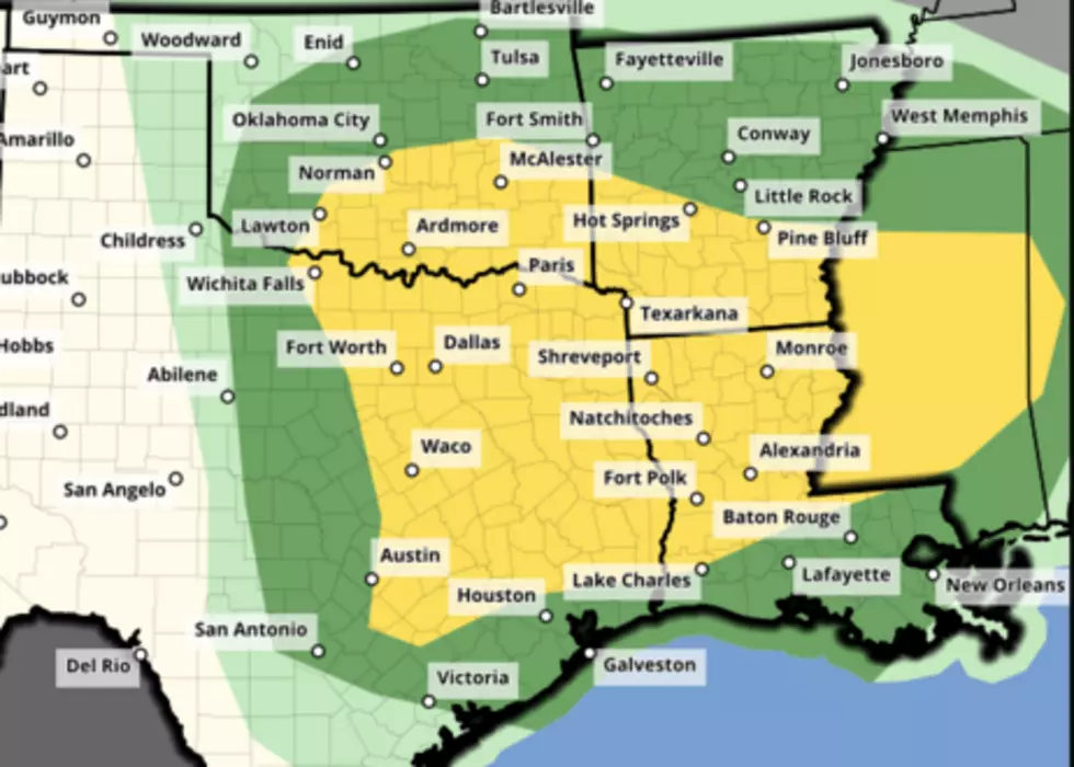
The Storm Prediction Center has placed a large portion of East Texas along with much of northern and central Louisiana under the gun for strong storms and severe storms. The geographic area, detailed in the image above, shows that the greatest areas of concern for the stronger storms is generally along and north of U.S. Highway 190
As of this forecast from the SPC, the Lafayette area and a large portion of Acadiana will be in the marginal risk zone for storms. The areas to the north and west will be in a slight risk zone for severe storms. These zones basically outline the probability of a severe storm passing within 25 miles of the forecast point. That's all the slight risk, marginal risk, enhanced risk jargon really means.
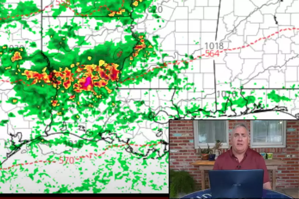
KATC's Rob Perillo has been running forecast models and the latest run that Rob has shared on the KATC website suggests that our storm activity might arrive until very late Wednesday evening and spill over into the wee small hours of Thursday morning.
Assuming we are able to avoid strong or severe storms, this would be a best-case scenario. We could use the rain. We could really use the rain while we are sleeping. And, we could use the rain.
A large portion of the state is currently facing very dry conditions and these are supposed to be the wetter months for the region. Once this storm system passes, the rest of the workweek into the weekend should be quite calm.
Do You Remember These 12 Stores?
More From News Talk 96.5 KPEL