
Timing the Worst of Today’s Severe Weather Threat in Louisiana
The National Weather Service and a host of highly educated meteorologists are in agreement that today's threat of strong to severe storms is not a matter of "if" but a matter of "when" they will occur. A robust upper-level storm system over Texas will be swirling a cold front through Louisiana today and the consequences of this atmospheric instability could be deadly.
The Storm Prediction Center has updated its outlook for today's severe weather threat and almost everyone who lives in Louisiana will be subjected to stormy conditions at least sometime during the day. It's "when during the day" that so many of you are wondering about. We are going to attempt to answer those questions for you.

Severe weather watches and warnings have already been posted in parts of Texas for these early morning hours. The likelihood that those watches and warnings will be updated to include portions of Louisiana later today is highly likely.
A Tornado Watch that includes portions of northwestern Louisiana is in effect until 8 am this morning. Chances are watches for central and southern Louisiana will be put into effect long before this watch expires. Here's the way the National Weather Service Office in Lake Charles has the timing of today's weather event broken down.

As you can see even the Weather Service is not exactly locked in on when the worst of the weather will pass by your town so we need to be ready and ready to act fast if severe conditions are present.
KATC Chief Meteorologist Rob Perillo is in agreement with the basic timing suggested by the National Weather Service. However, the HRRR Model, used by Perillo and the Storm Team Three Weatherlab are suggesting a more fine-tuned timetable for the worst of the weather's arrival. For example, the HRRR Model suggests this will be the scenario in Lake Charles at about 11 this morning.

The HRRR solution puts the strongest storms associated with this weather system moving through Cameron and Calcasieu Parishes just before lunch. If the model solution is accurate then just a few short hours later, this is what we'll be expecting in the Lafayette area.

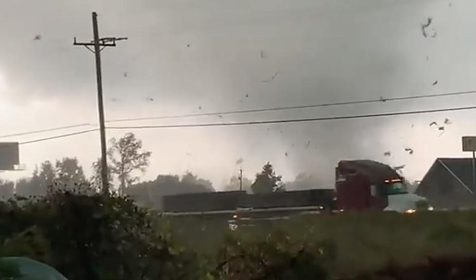
In addition to the potential for heavy downpours and frequent lightning, many of these storms will be accompanied by very gusty winds. It's possible that some wind gusts could exceed hurricane force during some of the stronger storms as they move through the area.
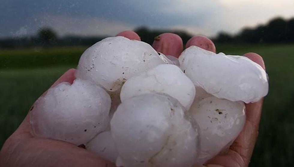
There is also the potential for hail. Some of those hailstones could be over one inch in diameter and that's more than enough to damage roofs and cars. So, take precautions where you can to avoid any necessary exposure to that aspect of the storm.
It does appear as those the most likely spots for stronger to severe storms will be along and north of the US 190 corridor but residents along and even south of I-10 will need to remain weather aware especially during the middle of the day.
We suggest you download our station app if you don't have it already. Make sure to enable your "Alerts". I would certainly enable Breaking News and Weather on a day like today.

10 Funniest Town Names in Louisiana
Gallery Credit: Jude Walker
More From News Talk 96.5 KPEL
