
Rain Chances Could Hit 70 Percent in Lafayette Later This Week
LAFAYETTE, La. — Acadiana opens the week under a ridge of high pressure that keeps afternoons hot and mostly dry through midweek, with a pattern change arriving by Thursday.
Highs are back in the low 90s to start the week, and while the heat sticks around, humidity stays manageable enough to keep heat index values in check. September is on pace to finish as the 4th or 5th hottest on record locally, and forecasters say the heat holding through midweek fits that trend.

That heat lingers into Tuesday and Wednesday before clouds start building ahead of the coming shift. However, Thursday is when the forecast is expected to shift.
Moisture pulled north from Hurricane Polo pushes into South Louisiana by midweek, and rain chances climb to 60 percent Thursday, 70 percent Friday and 60 percent Saturday as the system settles in.
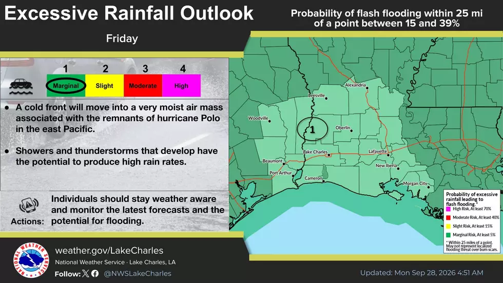
The main concern is heavy downpours and localized street flooding rather than severe weather, though the timing lines up awkwardly with University of Louisiana at Lafayette homecoming activities, which may need to shuffle around the rain. Saturday’s Arkansas State game remains on the schedule for now.
For anyone with outdoor plans this week, Monday through Wednesday remain the drier window. Once the moisture arrives, forecasters aren’t expecting a quick exit either: no real cold front looks likely for at least two weeks, and typical fall weather probably won’t show up before mid-October.
Nothing in the current outlook points to a tropical system directly threatening Acadiana. Tropical Depression Fay keeps weakening far out in the Atlantic, and no Gulf system currently carries any real chance of organizing before the weekend.
You May Also Like...
Most Feared Weather Events in Louisiana
Gallery Credit: Joe Cunningham
More From News Talk 96.5 KPEL